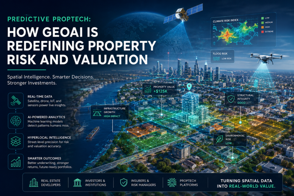
The global real estate landscape is experiencing a structural migration away from static data; historical valuation models that relied strictly on manual field surveys, backward looking comparable market analyses, and flat spreadsheet grids are breaking down under the weight of climate volatility and rapid urban development. In their place, a sophisticated framework has emerged at the intersection of spatial computing and advanced data science: Geospatial Artificial Intelligence.
For property developers, institutional investors, portfolio managers, and technology platforms operating within spaces like RealEstateMoses.com, understanding this paradigm is no longer a luxury; it is the fundamental mechanism for protecting capital and uncovering alpha in an increasingly volatile global market.
Location has never been a static variable; it is a fluid, continuous matrix of environmental pressures, economic shifts, infrastructure developments, and structural changes. This comprehensive guide details how spatial computing is rewriting the rules of property valuation and risk management globally.
- The Spatial Ingestion Layer
- The Algorithmic Engine
- The Core Python Spatial Library Ecosystem
- Conceptualizing the Python GeoAI Pipeline
- Precision Micro Climate Simulation
- Automated Structural Integrity Verification
- Quantifying the Micro Environment via Spatial Viewsheds
- Capital Migration Tracking and Logistical Proximity Analytics
- Digital Twins and 3D Gaussian Splatting Ingestion
- Blockchain Registries and Decentralized Spatial Auditing
- Navigating Spatial Ethics and Algorithmic Bias
- Phase 1: Spatial Data Standardization
- Phase 2: Structural Pipeline Integration
- Phase 3: Deploying Predictive Spatial Modeling
- Recommended Resources for Continued Spatial Study
To fully leverage spatial technology, real estate operators must first clear away the terminological fog that often surrounds advanced computation. The industry frequently conflates basic digital mapping with true autonomous spatial intelligence; it is essential to establish precise definitions.
GeoAI stands for Geospatial Artificial Intelligence: a specialized discipline that integrates geographic data science with machine learning architectures, computer vision deep learning networks, and predictive data processing pipelines. It represents the structural evolution of Geographic Information Systems; it transforms mapping platforms from descriptive data repositories into autonomous, cognitive engines capable of spatial reasoning.
Geospatial Artificial Intelligence is defined as the scientific and computational application of artificial intelligence methodologies to parse, model, simulate, and predict geographic data patterns at scale. Unlike standard artificial intelligence models that process unstructured text strings or tabular financial data in isolation, GeoAI natively accounts for Tobler’s First Law of Geography: the principle that all things are related, but near things are more related than distant things.
By hardcoding this spatial dependency directly into neural network layers, GeoAI evaluates information within its precise geographic, environmental, and temporal context. It gives computing systems the visual and spatial capability to interpret satellite feeds, drone scans, sensor arrays, and municipal registries simultaneously; it extracts structured insights from unstructured spatial imagery without requiring manual human interpretation.
GeoAI is the technology that bridges the gap between massive, unstructured earth observation data and automated real estate asset management. It is critically important today for three distinct reasons:
- The Velocity of Spatial Data Generation: Satellite constellations, aerial drone fleets, and mobile IoT sensors are capturing the surface of the earth at sub meter resolutions every hour. Human data analysts cannot process this multi terabyte stream; GeoAI serves as the clearinghouse that automatically converts millions of raw imagery pixels into structured data alerts.
- The Non Linear Progression of Climate Risk: Traditional actuarial tables rely on past historical cycles to predict future risks. As global climate patterns shift, these linear baselines fail; GeoAI builds dynamic, forward looking fluid dynamics and thermal simulations to accurately map risk zones before catastrophic weather events materialize.
- Hyper Local Market Fragmentation: Property values are heavily influenced by micro factors: the quality of the immediate street canopy, walkable access to amenities, solar potential, noise pollution, and local maritime or logistical infrastructure shifts. GeoAI quantifies these subjective features, turning environmental qualitative attributes into hard mathematical inputs for pricing models.
Organizations like the Open Geospatial Consortium emphasize that establishing standardized spatial AI frameworks is vital for future urban resilience; it gives operators the ability to see trends across entire continents while preserving hyper local accuracy.
To understand how GeoAI impacts asset valuation, one must analyze the computational pipeline that transforms raw environmental inputs into predictive real estate intelligence. The operational stack relies on a multi layered ingestion system.
+-----------------------------------------------------------------+
|                       SPATIAL DATA INPUTS                       |
|  (Satellite Raster, LiDAR Point Clouds, IoT Traffic Streams)    |
+-----------------------------------------------------------------+
                                |
                                v
+-----------------------------------------------------------------+
|                       NEURAL EXTRACTION                         |
|  (Computer Vision Segmentation, Spatial Attention Layers)       |
+-----------------------------------------------------------------+
                                |
                                v
+-----------------------------------------------------------------+
|                   CONTEXTUAL CONVERGENCE ENGINE                 |
|  (Zoning Codes, Transaction Histories, Capital Migration Data)  |
+-----------------------------------------------------------------+
                                |
                                v
+-----------------------------------------------------------------+
|                   PREDICTIVE UNDERWRITING OUTPUT                |
|  (Hyper Local Valuation Models, Forward Looking Risk Scores)    |
+-----------------------------------------------------------------+
The Spatial Ingestion Layer
The process begins with the structural extraction of distinct spatial data formats:
- Raster Imagery Data: This includes multi spectral and orthophotographic imagery sourced from satellite constellations or low altitude aircraft. These grids contain numerical values representing light reflectance across visible and invisible wavebands; this allows algorithms to identify structural composition, vegetation health, and moisture levels.
- Vector Geometries: Point locations, polyline networks, and polygon boundaries that represent real world coordinates; this covers building footprints, utility corridors, tax parcel perimeters, and transit networks.
- Three Dimensional Point Clouds: Dense files generated via Light Detection and Ranging, commonly referred to as LiDAR, or through photographic reconstruction. These data points provide millimeter level structural coordinates; they are essential for analyzing terrain slope, roof pitch, and structural heights.
- Dynamic Spatial Feeds: Live telemetry from cellular networks, vehicle GPS streams, maritime shipping transponders, and local climate sensors that measure the heartbeat of an urban market in real time.
The Algorithmic Engine
Once these data streams are aligned to a unified coordinate reference system via geometric correction pipelines, they are fed into advanced neural network architectures:
- Convolutional Neural Networks (CNNs): Specialized deep learning frameworks that apply mathematical filters to spatial pixel arrays. CNNs are highly effective at semantic segmentation; this allows them to isolate a specific building footprint from surrounding foliage and classify its roof style automatically.
- Spatial Transformers and Attention Mechanisms: Algorithms designed to evaluate long range geographic relationships. Instead of looking at a single property parcel in isolation, attention models analyze how adjacent commercial developments, transportation hubs, and geographic topographies collectively influence the target asset.
- Graph Neural Networks (GNNs): Models that treat urban spaces as interconnected webs of nodes and edges. Properties are modeled as nodes; transit times, walking paths, and infrastructural pipelines form the edges. GNNs allow real estate platforms to simulate how a major change in infrastructure cascades through an entire metropolitan ecosystem.
For data scientists and software developers building modern PropTech platforms, the technological implementation of spatial AI occurs within an open source programmatic ecosystem.
GeoAI Python refers to the unified collection of programmatic libraries, statistical packages, and deep learning frameworks written in the Python language that are used to ingest, clean, manipulate, train, and deploy spatial artificial intelligence models. Python has become the industry standard for spatial computing because it bridges the gap between traditional geometric database manipulation and modern deep learning stacks.
       +-------------------------------------------------------+
       |                 THE GEOAI PYTHON STACK                |
       +-------------------------------------------------------+
       |  DEEP LEARNING / AI:   PyTorch, TensorFlow, PyG       |
       +-------------------------------------------------------+
       |  GEOMETRIC HANDLING:   Shapely, Fiona, PyProj         |
       +-------------------------------------------------------+
       |  RASTER & VECTOR DATA: GeoPandas, Rasterio, Xarray    |
       +-------------------------------------------------------+
       |  CORE DATA INFRA:      Pandas, NumPy, SciPy           |
       +-------------------------------------------------------+
The Core Python Spatial Library Ecosystem
Building a production grade GeoAI pipeline requires orchestrating several core components within the Python environment:
- GeoPandas: An extension of the standard Pandas data analysis library that introduces a specialized Geometry column type. It enables developers to execute complex spatial operations; such as spatial joins, coordinate transformations, and geometric intersections; across millions of rows using optimized vector computing matrices.
- Rasterio: A library built to access and manipulate geographic raster formats, such as GeoTIFF files. Rasterio allows developers to read satellite imagery bands as multi dimensional NumPy arrays, enabling rapid pixel level math, vegetation index calculations, and training data creation for computer vision models.
- Shapely: A package focused on the manipulation and analysis of planar geometric shapes. It handles polygon checking, line intersections, and buffering operations; providing the computational geometry foundation for spatial cleaning pipelines.
- PyTorch Geometric (PyG): A specialized deep learning extension for PyTorch designed to handle irregular structured inputs like geographic graphs. This allows developers to pass complex street networks and parcel relationships directly into graph neural networks.
- The Esri ArcGIS API for Python and ArcPy: Enterprise grade tools that allow data teams to connect open python scripts directly with robust geospatial databases, spatial analytics servers, and global vector tile layers.
Conceptualizing the Python GeoAI Pipeline
In practice, a Python driven spatial artificial intelligence pipeline acts as an automated processing factory. The system loads massive, unstructured geographic raster tiles and corresponding property polygon records simultaneously.
Using Rasterio, it crops the satellite imagery exactly to match the coordinates of building footprints provided by GeoPandas. These image arrays are converted into normalized multi dimensional tensors and passed through a PyTorch computer vision network.
The model analyzes the structural pixels, determines the asset attributes; such as identifying the roof material or counting available parking bays; and attaches those extracted values directly back onto the property data frame as structured features. This entire pipeline operates programmatically at scale, analyzing thousands of property structures in minutes without manual intervention.
The insurance and banking sectors have historically quantified property risk using coarse geographic resolutions; such as evaluating risk across entire postal codes or broad river basins. GeoAI has dismantled this imprecise methodology by introducing asset level, micro spatial risk underwriting.
Precision Micro Climate Simulation
By ingesting high resolution terrain maps generated via airborne LiDAR, GeoAI algorithms construct high precision digital elevation models. When paired with fluid dynamics equations, these models simulate how flash flood waters will interact with individual buildings on a specific street.
The model can determine if water will accumulate at the foundation of a specific structure or bypass it entirely based on the precise angle of the street pavement. In coastal zones, GeoAI models process historical satellite radar datasets to measure shoreline change rates down to the millimeter; this allows investors to forecast the exact year a premium seaside structure will face structural foundation risks due to rising water tables.
+-----------------------------------------------------------------------------+
|                     TRADITIONAL VS. GEOAI RISK PROFILING                    |
+-----------------------------------------------------------------------------+
| METHODOLOGY     | TRADITIONAL PROPERTY UNDERWRITING  | GEOAI INSIGHTS       |
+-----------------+------------------------------------+----------------------+
| Resolution Scale| Broad postal code or municipality  | Exact asset polygon  |
| Data Dynamic    | Static historical cycles (Linear)  | Real time predictive |
| Structural Bias | Assumes uniform roof/site safety   | Individual computer  |
|                 | across the neighborhood zone       | vision verification  |
+-----------------------------------------------------------------------------+
Automated Structural Integrity Verification
Instead of dispatching property inspectors to review buildings manually, institutional asset managers deploy computer vision pipelines across scheduled high resolution aerial feeds. These models automatically isolate individual rooftops to detect microscopic changes over time:
- Material Degradation Tracking: Identifying the loss of protective granules on asphalt shingles or detecting early corrosion patterns on standing seam metal roofing systems.
- Vegetation Encroachment Quantification: Measuring the exact growth rate of tree canopies relative to structural roof lines and power connections, allowing predictive calculation of windstorm damage probabilities.
- External Hazard Mapping: Scanning neighboring parcels to verify the presence of unmapped fire hazards, unpermitted structural expansions, or industrial storage zones that negatively affect the target property’s safety profile.
Traditional Automated Valuation Models, commonly referred to as AVMs, rely heavily on historical hedonic pricing methods; they assess value by looking at interior variables like bedroom counts and matching them with recent transaction records within a set distance radius. While useful, this approach fails to capture the hidden geographic drivers that dictate true real estate value. GeoAI expands the valuation equation by introducing deep contextual features.
Quantifying the Micro Environment via Spatial Viewsheds
One of the most powerful features of GeoAI is its ability to run viewshed analyses at scale across entire residential markets. By utilizing 3D point clouds and building massing models, a spatial neural network calculates the exact percentage of an asset’s window views that face green canopies, open water features, or industrial obstructions.
Instead of assuming two identical units in a premium high rise carry the same value, GeoAI can isolate the exact premium associated with a clear skyline view versus a view obstructed by adjacent infrastructure. This level of granular insight allows platforms like PySAL to empower advanced regression modeling, bringing unmatched precision to modern real estate analytics.
+------------------------------------------------------------------------+
|                    THE DYNAMIC GEOAI VALUATION MODEL                   |
+------------------------------------------------------------------------+
|  [Interior Core Specs]    -> Square Footage, Bedroom Count, Age        |
|  [Micro Environmental]    -> Viewshed Score, Sky Exposure, Tree Canopy |
|  [Logistical Proximity]   -> Walking Friction, Freight Access Nodes    |
|  [Macro Spatial Capital]  -> Port Velocity, Regional Infrastructure     |
+------------------------------------------------------------------------+
|                        TOTAL PREDICTIVE VALUATION                      |
+------------------------------------------------------------------------+
Capital Migration Tracking and Logistical Proximity Analytics
In commercial and industrial logistics real estate, asset valuation is driven heavily by proximity to trade corridors and transport hubs. GeoAI tracks macro infrastructure investments by analyzing changes in satellite radar signatures and mobile data flows over time.
For example; by tracking container throughput velocities at major port developments, such as emerging maritime infrastructure zones in west Africa or major European logistics lanes; GeoAI can predict shifts in nearby warehouse demand up to eighteen months before those moves surface in traditional commercial real estate reports.
The algorithm calculates “walking friction” and logistical transit times rather than simple straight line distance; it models traffic congestion patterns, street grade variations, and intersection delays to assess the true connection efficiency of an asset to urban centers.
As the real estate technology ecosystem matures, GeoAI does not operate in a vacuum; it functions as the central analytics engine for a cluster of intersecting digital paradigms.
Digital Twins and 3D Gaussian Splatting Ingestion
The rapid rise of 3D Gaussian Splatting (3DGS) has revolutionized the speed at which physical spaces are captured and turned into photorealistic digital environments. While 3DGS provides unmatched visual fidelity for virtual walk-throughs and luxury asset tours, it produces raw, unclassified volumetric data.
GeoAI serves as the semantic parser for these models. When a drone generates a 3DGS model of a luxury estate or commercial building, GeoAI steps in to automatically classify the underlying point structures; it isolates structural walls, measures interior ceiling heights, calculates light exposure angles, and extracts precise architectural styles directly from the visual model.
Blockchain Registries and Decentralized Spatial Auditing
The integration of real estate titles with blockchain ledgers promises to secure land tenure and streamline property transactions globally. However, a digital token on a ledger is only as reliable as the physical boundaries it represents.
GeoAI acts as the automated clearinghouse for decentralized registries. By constantly cross referencing land titles with real time satellite imagery, spatial algorithms ensure that the digital polygon coordinates recorded on the blockchain accurately reflect physical fencing, shoreline shifts, and structural developments in the real world; this prevents title fraud and automates the resolution of boundary discrepancies.
Navigating Spatial Ethics and Algorithmic Bias
With the immense power of predictive spatial intelligence comes significant ethical responsibility. Real estate professionals must actively guard against digital redlining; the risk where machine learning models inadvertently inherit historical human prejudices.
If a GeoAI model is trained on historic lending data without strict ethical guardrails, it may flag certain neighborhoods as high risk or artificially depress property valuations based on historical investment biases. Operators must ensure their models focus strictly on objective, measurable physical parameters; such as structural integrity, actual terrain slope, environmental hazard frequencies, and verified proximity markers; rather than historical socio economic proxy variables that perpetuate structural inequality.
For organizations aims to integrate Geospatial Artificial Intelligence into their existing business pipelines, the transition requires a structured approach. Success depends on building a robust foundational data environment.
Phase 1: Spatial Data Standardization
Begin by cleaning your portfolio’s existing asset registries. Ensure that every single physical asset is represented not just by a mailing address or a static latitude and longitude coordinate; but by a verified, closed polygon geometry that maps the exact parcel boundaries. Transition all internal database systems to support spatial querying protocols, such as enabling PostGIS extensions on standard PostgreSQL databases.
Phase 2: Structural Pipeline Integration
Connect internal property records with open earth observation pipelines. Establish automatic APIs to ingest foundational spatial layers from platforms such as NASA EarthData; this grants your analytical systems continuous access to daily climate tracking, vegetation indices, and regional environmental changes. Integrate these feeds directly with your core valuation algorithms.
Phase 3: Deploying Predictive Spatial Modeling
Train localized machine learning pipelines to augment your standard valuation procedures. Use Python spatial ecosystems to overlay hyper local variables; viewshed data, precise transit accessibility scores, and structural wear tracking; onto your asset underwriting sheets. By monitoring these spatial shifts continuously, your platform can move away from reactive quarterly appraisals; entering a state of continuous, predictive valuation that protects capital and uncovers hidden market arbitrage opportunities before the broader market reacts.
REM Concludes: GeoAI represents the ultimate convergence of physical geography and digital data intelligence. In the modern property market, an asset is no longer defined simply by its bricks and mortar; it is defined by its position within a dynamic, shifting web of spatial risks and opportunities. By deploying spatial intelligence pipelines today, forward thinking real estate platforms ensure they are not merely observing market transformation; they are actively underwriting it.
Recommended Resources for Continued Spatial Study
- The Open Geospatial Consortium (OGC): https://www.ogc.org ; The international standards organization driving interoperability across global spatial data analytics platforms.
- Esri Geospatial Intelligence Resources: https://www.esri.com ; The global pioneer in geographic information systems and enterprise spatial deep learning tools.
- The Python Spatial Analysis Library (PySAL): https://pysal.org ; The definitive open source platform for advanced geographic data science and spatial regression pipelines.

Moses Oyong is a Real Estate Growth Marketing Manager and PropTech specialist with over a decade of closing residential and commercial deals worth over 200 million across Nigeria and international markets. Known for engineering AI-driven workflows that delivered a 69% uplift in sales targets and cut lead response times by 85%, Moses bridges the gap between high-performance marketing, land law, and technology to help investors, developers, and first-time buyers make confident, informed property decisions in an increasingly digital world.